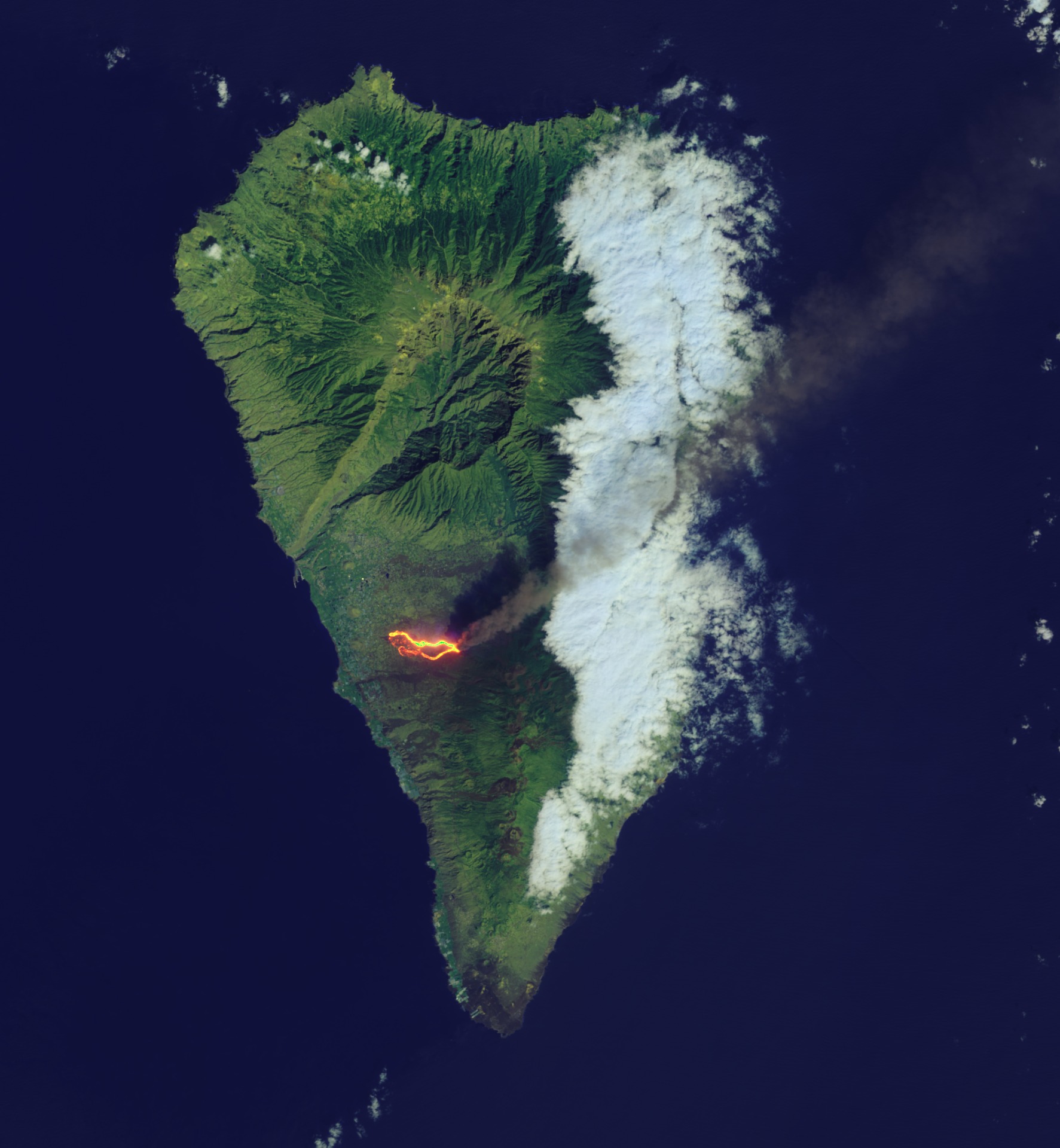
The geology and dangers of La Palma
La Palma is composed entirely of volcanoes, and so are the six other Canary Islands. We explore the geological panorama in which this archipelago has formed and why it is both terrifying and attractive for its people, tourism and food production.
Author: Kathelijne Bonne.
The volcanic origin of the Canary Islands generates a myriad of relief forms. Volcanic eruptions, the dry Sahara wind and the moist ocean breeze, rain and drought, and the action of the waves on the rocky volcanic coasts have created a great variety of landscapes and ecosystems. Jagged lunar landscapes with deep ravines alternate with lush rainforest, black beaches give way to golden dunes of windblown Sahara sand.

La Palma rises 2400 meters above sea level, and if we add to that the 4000 meters below the sea, we have a volcanic massif of 6400 meters height. By comparison, the most famous volcano in the archipelago is Teide, not only the largest volcano and mountain peak in Spain (3,718 m) but also the third largest volcano in the world. From its base on the ocean floor, it measures a mind-boggling 7500 meters.
Such volcanoes offer a range of benefits, but they also hold a few dark secrets. But we'll start with a positive attribute.
Fertile volcanic soils
Thanks to volcanism, the soils of the Canary Islands are particularly rich in minerals, which is very beneficial for agriculture. The islands are famous for their banana crops and they supply all Spanish supermarkets.
Volcanic soils are among the most fertile in the world and have contributed to the rise of many great civilizations, such as Ancient Egypt. In fact, the famously fertile river banks of the Nile have volcanic origin as described in our article on the Great Rift Valley of East Africa.
Tsunami
La Palma consists of five volcanoes, the other four of which are extinct. The geology of La Palma shows two parts.
In the north there is a very large craterlike feature, the Caldera de Taburiente, which was not formed by an eruption but is the scar of a huge landslide and erosion by deeply incised rivers.
Landslides are common on volcanoes, and while they are life-threatening in themselves, it can get worse if the volcano is located near the sea. Then they can cause a tsunami. In 2001, La Palma and Cumbre Vieja made it to the headlines because a research article, published by the American Geophysical Union, revealed that one unstable part of the volcanic flanks may detach and collapse into the sea, producing a mega-tsunami, possibly reaching the coast of North America.
The nine-kilometer-wide Caldera de Taburiente opens to the sea through the Barranco de Angustias, the canyon of fear, and is surrounded by mountains whose rocks are the remains of extinct volcanoes.
The Cumbre Vieja volcano occupies the southern part of La Palma and is 1949 m high. The summit area is dotted by many small craters. The volcano's relief is more smooth than the jagged topography of the Caldera de Taburiente in the north.

The Canary Islands rise from the sea
The island of La Palma formed 1,7 million years ago when an older submarine volcano first appeared above the ocean surface. But the entire archipelago with its islands and submarine volcanoes (seamounts), known to geologists as the Canary Volcanic Archipelago, is much older. It was formed 70 million years ago at the end of the Cretaceous period. It took another 50 million years before the submarine volcanoes rose above the sea. From east to west, they emerged one by one: Lanzarote and Fuerteventura are the oldest (20 m.y.), followed by Gran Canaria, Tenerife, La Gomera, and La Palma (1.7 m.y.) and the youngest island, El Hierro (1.1 m.y.). But why do these volcanoes occur in this part in the Atlantic Ocean, far from the boundaries of the tectonic plates where most volcanoes in the world are located?
Mantle Plume
The Canary Volcanic Province is located on the African tectonic plate and the volcanism is most likely caused by a hot-spot. From the edge of the Earth's outer core, at a depth of 2,900 kilometers, plumes of hot mantle material rise to the surface. This causes a hotspot, as in the Canary Islands. Due to the heat, the rocks in the Earth's crust melt, causing volcanoes to erupt. Relative to the Earth's core, the plume has a fixed position, but the tectonic plates move horizontally and slide over such hotspots.
As the Atlantic Ocean widens due to plate tectonics, the African tectonic plate slides over the Canary mantle plume, leaving a trail of volcanoes that migrates westward as time (millions of years) go by. This type of volcanism is located far from the edges of the tectonic plates, where more dangerous volcanoes normally occur, such as in the Ring of Fire of the Pacific Ocean. The hotspot origin of the Canary Islands is the best hypothesis for the origin of the islands, but there are other theories as well.
Some other hotspot volcanoes in the world include the volcanoes of Hawaii, Iceland, the Azores, Galapagos, Yellowstone, Mauritius and the Eifel (Germany), each with a unique set of landscapes and hazards.
------------
Read more about the details of the 2021 eruption of Cumbre Vieja or other volcanoes we wrote about:
Title image: Copernicus/Sentinel2.
Sources:
https://www.mantleplumes.org/Canary.html
Numerical modeling of tsunami waves generated by the flank collapse of the Cumbre Vieja Volcano (La Palma, Canary Islands): Tsunami source and near fieldeffects. https://agupubs.onlinelibrary.wiley.com/doi/full/10.1029/2011JC007646#jgrc12375-bib-0067
Cumbre Vieja Volcano-Potential collapse and tsunami at La Palma, Canary Islands https://agupubs.onlinelibrary.wiley.com/doi/full/10.1029/2011JC007646

Article by Kathelijne Bonne, geologist & soil scientist, GondwanaTalks Editor.
Latest articles:
cumbre vieja tsunami, la palma tsunami, la palma landslide, canary islands geology, geology of la palma, canary islands hotspot, cumbre vieja landslide, la palma flank collapse, cumbre vieja flank collapse
